
From collection Place
State of Maine created from the Commonwealth of Massachusetts' District of Maine. The geographic center, or that point on which a surface of uniform thickness would balance, for the state is located in Piscataquis County, 18 mi N of Dever.
Related Items

River Herring Co-management in Downeast Maine
A final project for College of the Atlantic's Fisheries, Fishermen, and Fishing Communities course 2023
Hancock County's Fragmented Farmland
An exploration of current and possible agricultural land on this coastal county in Maine.
Solar Potential of High Electricity Cost States
These maps support the business plan of ImpactGreen with the goal to eliminate fossil fuels from electricity production.
Aroostook Renewable Gateway GIS
A Geographic Information System designed to enable the public to make their own maps of interest along the proposed Gateway corridor
Mount Desert Rock Oceanography Survey
A look at oceanographic data around Mount Desert Rock for the 2019 and 2021 seasons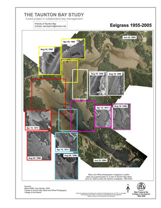
The Taunton Bay Study: Eelgrass 1955-2005
Changes in Eelgrass over time in Taunton Bay, headwaters of Frenchman Bay
Whales and Climate Change
The Gulf of Maine is a large body of water in the Northern Atlantic, home to extraordinary marine wildlife. The Gulf of Maine borders on three US states, Maine, New Hampshire, Massachusetts, and two Canadian provinces: New Brunswick and No…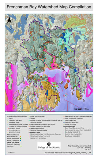
Frenchman Bay Watershed Map Compilation
Frenchman Bay Watershed Map Compilation Shows numerous features and land uses within the watershed of Frenchman Bay
State Senate certification
A certification that the named person is a member of the state senate of Maine's 100th legislature.

